Undermaps
Pricing. There's a free plan to get you started. Paid plans start at A$149 one-time. See full pricing · Updated November 10, 2026
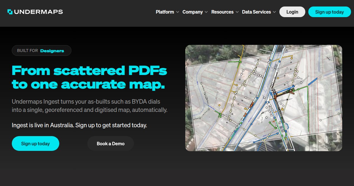
Undermaps Ingest is a web service that turns BYDA dials, as-builts, and utility PDFs into a georeferenced utility map with per-job pricing in AUD and a first job free for new customers in Australia.

Utility coordination teams in Australia often receive BYDA dial-before-you-dig packages, as-builts, and PDFs from multiple asset owners. Undermaps Ingest consolidates those inputs into one georeferenced map you can filter, measure, and share by link, as described on undermaps.com.
Pricing is per job in Australian dollars. New customers receive one free job per company, then Small jobs from AUD $149, Medium AUD $299, and Large AUD $499 according to the Ingest FAQ checked 10 November 2026. Very large scopes are quoted on application, and most jobs return within about 12 hours per the same FAQ.
Outputs can export to GeoJSON, CAD/DXF, and PDF, with utilities colour-coded to AS5488 where applicable. Compare with 4M Analytics on the GIS & Site hub when you evaluate utility data platforms.
Specifications
Pricing
Platforms
Used for
Used by
Tasks
Pros and cons
Pros
- First job free for new customers with published AUD tier prices
- No recurring subscription required for Ingest per FAQ
- Exports to GeoJSON, DXF, and PDF for GIS and CAD workflows
Cons
- Pricing and free-job offer are positioned for Australia on undermaps.com
- Per-job model needs scoping for multi-site programmes
- Very large jobs require a custom quote
Key features
Single map output: Ingest merges BYDA dials, as-builts, historical plans, and utility PDFs into one georeferenced utility map per undermaps.com.
Source traceability: Deliverables keep source documents alongside the map; filters, measure tools, and share links are documented on the Ingest pages.
AS5488 colour coding: FAQ copy states utilities can be colour-coded to AS5488.
Turnaround: Undermaps states most jobs complete within 12 hours with human review before delivery.
Team access: FAQ notes unlimited team access on an organisation account and ISO 27001 certification.
Pricing
First job (new customers)
Free
One free job per company for new Ingest customers on undermaps.com/ingest-free-job.
Small job (AUD)
A$149.00
AUD $149 per Small job per undermaps.com/ingest/faq.
Medium job (AUD)
A$299.00
AUD $299 per Medium job per undermaps.com/ingest/faq.
Large job (AUD)
A$499.00
AUD $499 per Large job per undermaps.com/ingest/faq.
Prices come from each vendor’s public listings and can change. Double-check the current price on the vendor site before you buy.
Frequently asked questions
How much does Undermaps Ingest cost?
Undermaps prices Ingest per job in AUD: Small $149, Medium $299, Large $499, with very large jobs quoted on application (undermaps.com/ingest/faq, verified 10 November 2026). New customers get one free job per company.
Is Undermaps Ingest free to try?
Yes for eligible new customers. undermaps.com/ingest-free-job offers one free consolidated map per company before paid tiers apply.
What file formats can Undermaps export?
Marketing and FAQ pages list export to GeoJSON, CAD/DXF, and PDF alongside browser viewing and share links.
Does Undermaps work on mobile?
Undermaps states Ingest works on desktop, tablet, and phone via the web application on undermaps.com.
Undermaps vs 4M Analytics for utility data?
Both help teams work with buried utility information. Undermaps focuses on turning BYDA and PDF packages into georeferenced maps with per-job AUD pricing, while 4M Analytics offers a different data product mix. Compare scope on each vendor site.
Tutorials and learning
- Ingest free jobDocs
- Ingest FAQDocs
Sources
Other GIS & Site tools
- Virtual SurveyorFreemium
Virtual Surveyor is desktop drone-surveying software that turns orthomosaics, elevation models, and point clouds into CAD-ready linework,
- WingtraEnterprise quote
Wingtra is a VTOL fixed-wing drone surveying platform with WingtraCLOUD processing that targets repeatable centimeter-grade maps, point
- 3D City DatabaseOpen source
3D City Database is an open-source CityGML database and toolset for storing, importing, exporting, analyzing, and visualizing virtual 3D
- 4M AnalyticsEnterprise quote
4M Analytics is a Utility AI mapping platform that pulls together public utility records, AI-assisted detections, and human review into one
Agisoft Metashape is photogrammetry software that processes digital images into 3D spatial data such as dense point clouds, textured meshes,
- AirWorksEnterprise quote
AirWorks is a geospatial field intelligence service that combines aerial and terrestrial capture with analyst-reviewed AI mapping to deliver
- AnoriEnterprise quote
Anori is a web-based generative AI platform for the built environment that ties site data, policy checks, and stakeholder views together so
- ArqgenEnterprise quote
Arqgen is a Brazil-focused web platform for generative architecture and land feasibility that turns survey-style site inputs and municipal